9 min. read
Sophia Schuff is a transdisciplinary project manager and urban anthropologist based in Gehl’s Copenhagen studio, who specialises in integrating ethnographic research methods, urban design and engagement facilitation skillsets to further the impact of design solutions that the team implements.
To frame the conversation, what is the Thrive Zone initiative, and how is Gehl taking an approach to tackling air quality through urban design more broadly?
The Thrive Zone initiative is a neighbourhood based strategic approach to tackling air pollution. The idea is that we can use design to affect health outcomes and create neighbourhoods that help people thrive. The initiative was born out of a partnership with the Bernard van Leer Foundation, and focuses on how small children and caregivers use the urban environment and how in turn, the urban environment influences early childhood development. We created the Thrive Zone concept to showcase urban design principles and strategies for the purposes of increasing neighbourhood health.
Many cities and Mayors have air pollution on the agenda and are working hard to tackle it. However, a lot of this work is taking place at the policy level, which tends to take a long time to trickle down to the everyday life of inhabitants. As urban designers, we’re really interested in how design, today, can combat exposure to air pollution and influence health outcomes for people living in polluted areas.
The Thrive Zone project in London is funded by Guy’s and St Thomas’ Charity, who have a new program called Impact on Urban Health. They are seeking to tackle the harmful effects of air pollution for vulnerable populations in the boroughs of Southwark and Lambeth. They asked us to work with Lambeth borough to look at how air pollution affects people’s everyday lives, their lived experience, and how urban design solutions could address these challenges.
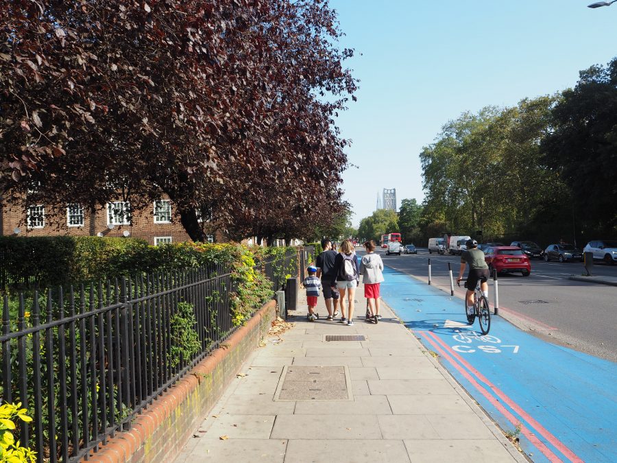
We have been working in the heavily affected area of Vauxhall. There are major A3 roads that dissect the neighbourhood, as well as a gyratory that is producing a lot of the primary pollutants, on top of ambient pollution created by nearby industry. It’s a pollution hotspot, and our role was to build an evidence base of the lived experience of people, and to identify how certain interventions could affect exposure.
Air quality can be a highly technical matter. The Thrive Zone initiative draws upon ‘lived experience data’ in its mission to achieve healthier environments. Could you expand on what this includes, and why it is important?
Cities, and especially London, are getting very good at collecting particulate matter (PM10/2.5) and nitrogen oxides (NOx) data. This type of data is fine-grained in the sense that you know where the pockets of air pollution are, and you get a picture of pollution peaks in a day. To compliment this, we use our unique approach of collecting people’s lived experience data, that allows us to understand how people actually use the urban environment: where they move, where they dwell, which demographics use certain streets or spaces at a given time.
By combining these two data sets – the human experiences of the city and the air pollution statistics – we can identify relations between the two and begin to visualise and ‘see’ patterns. One example is that we can see when people’s activity peaks on certain streets and compare that to air pollution peaks. That directs us to look and understand what qualities of the urban environment exist there, and start to think what changes might be appropriate to improve the conditions for people to spend time in that space in a healthier way.
In Vauxhall, we could see through our data collection that the streets where small children and their caregivers were spending the most time were also the areas with the highest levels of particulate matter. This gave us the evidence basis to recommend design and policy solutions to mitigate that.
Part of our process into mapping lived experience is conducting online surveys. We received almost 300 responses, where we asked a lot of questions about people’s daily lives: their daily routes, what parks they visit, their favourite and least favourite places to dwell. When you layer these places with air pollution maps you can see that the places with the lowest air pollution levels are generally people’s favourite places, where people aspire to spend time. This is an obvious indication of where we can intervene, to make further invitations for people to walk, bike and spend time in the places that have the right conditions for better air quality. Through wider sidewalks, vegetation buffers and many small tweaks in infrastructure, we can make this invitation happen.
One of the solutions proposed for Thrive Zone is to prioritise pedestrian movement over cars. What impact does that have on air quality, and how do you think car centric planning paradigms can be replaced by active mobility modes?
We know that people thrive when using active mobility options: stress decreases, and social interactions at the street level as well as the positive sensory experience of the urban environment increases. We also know from our work with micro mobility providers that there is an important equity lens when it comes to promoting active mobility and public transportation. They can influence the ability of people to access different parts of the city, necessary amenities, and meet their daily needs.
Currently, the planning paradigm of a city like London has made it so that services and amenities are clustered along the nodes that have the highest levels of pollution. That’s why we are making maps that show alternative neighbourhood uses. We have suggested using the invite + reduce approach, which reprioritises the way people move through neighbourhoods, inviting them into the less polluted street networks, and clustering services and amenities like playgrounds, schools, shops and cafes into the area’s network that have lower pollution levels.
This invite + reduce approach is novel when looking at city design, and we are now taking one of the pilot interventions forward with Transport for London. We are proposing a pedestrian network in the north of the ward, on Durham street, which is where St Anne’s primary school is located. We want to see if we can shift car dominance in the area to a pedestrian friendly hub to reduce levels of pollution. We will create wider sidewalks, a convenient through lane for cyclists, introduce cleaner air planting and push back car parking so it isn’t near the school.
How do local inhabitants typically react to this kind of intervention?
We sometimes get pushback from car users and local businesses. Businesses are often afraid that if car parking is removed, then people won’t come. Of course, in some cities that don’t have thriving street life or robust public transportation it may be true, but in London, and a lot of dense European cities, making that transition isn’t hard for people. It’s also been shown that pedestrians and bicyclists are more likely to stop and buy something on the street than car drivers for example.
Our strategy to increase buy-in is to promote piloting to show what urban transformation can achieve. With a small budget, citizen engagement and piloting it can be easier to achieve ambitious plans with the city and local partners. For example, we often propose interventions that shut down lanes to traffic and widen sidewalks, only temporarily. Piloting in this way can show what the possibilities are, and help us collect evidence as a dialogue tool with different stakeholders such as caregivers, local residents, businesses or decision makers. We can show the statistics and ask how the project increases quality of life, how it influences everyday life, changes travel time perception, and we can collect air quality data to understand the technical change as well. Data is the most important thing. If we don’t have those numbers to measure people, pollution, or car traffic, it’s hard to make big decisions. Layering lived experience data from pilots with other reliable data sources such as air quality data can tell the stories needed about the future residents want for their city.
Air pollution often has the gravest of impacts on the most vulnerable communities. How does Thrive Zone seek to address this inequality? And what learnings can we take from Thrive Zone to effectively address such injustices?
We were really pleased to partner with The Social Innovation Partnership, a research innovation organisation based in South London that conducts community research. They are truly embedded in the neighbourhoods that we are working in, and have an array of local folks that want to get involved in projects that positively change the environment they live in. These are communities that have suffered from historic disinvestment, and so it’s interesting to collect a hyper-local dataset with people who are living in the community, and centre their needs and conversations in the design process so that those ultimately in charge can hear the stories from inhabitants directly.
One of the reasons we do data collection is that often people don’t necessarily have the vocabulary to identify what needs to change, but have the perfect vocabulary to tell you what their everyday experience is. Those stories and first-hand accounts paired with people-centred data gives a complete picture of inequities and vulnerabilities, and where specific opportunities for improvement are. You start to get a better idea of where small children spend time with their caregivers, what bus routes mums are using and what roads they use to get there. This isn’t always choice ridership but necessity ridership, so these are the roads where the biggest changes need to happen.
We have a huge opportunity to influence the quality of life and health outcomes of people if we actually make changes now. An example of one of the solutions we have designed in this project is around reshaping bus stops. We know that when people stand on a busy road, the likelihood of pollution exposure increases tremendously. If they are invited to sit even a few meters back from the side of the road, their exposure goes down. Unfortunately, right now there isn’t much research and evidence on this, therefore we need to build and test these solutions so we have the ammunition to go to Transport for London, for example, and propose to reshape the orientation of bus shelters away from the road, implement friendly air planting, and push back the seating by just a few meters. Simple tweaks to standardise urban elements such as bus stops could really change health outcomes of a child that uses that bus network everyday.
This all goes back to linking urban design with people’s everyday habits and choices as a crucial way to tackle inequalities in our neighbourhoods. Policy can of course help but it takes time. Very recently, for the first time, air pollution was listed as a cause of death for Ella Adoo-Kissi-Debrah, a young girl who died in London in 2013. This demonstrates the extreme urgency of our situation. If we don’t start testing these urban solutions and only rely on policy to cut emissions at the industrial level industry, we won’t see change that is fast enough, nor at the local scale to make a difference in children’s lives today, tomorrow, even in years to come. We already know what design solutions need to happen, we just need stronger leadership to put them in place.